Hike to the M: One of Missoula’s Most Iconic Trails
As your airplane descends through the clouds and makes its little arch toward Missoula Airport, look out the window on a clear day. You’ll probably spot it — that big white “M” sitting high on the side of Mount Sentinel.
And if you’re staying with us at The Hohnstead, you’ll be happy to know that you can go from your little cabin in the woods to standing underneath that M in about 25 minutes. Not bad for a morning adventure.
The M is one of those things you notice pretty much immediately when you arrive in Missoula. It’s on T-shirts, in photographs, on postcards, and locals use it as a landmark. University of Montana students run up and down it like it’s no big deal.
Meanwhile, the rest of us are standing at the bottom thinking, Wait... we're going up there?
From an airplane, the M looks surprisingly small. From the parking lot, Mount Sentinel looks a little more serious. The good news is that the hike itself is short. The less good news is that it goes pretty much straight up.
The trail climbs about 620 feet in elevation over roughly 0.75 miles, with a series of switchbacks taking you toward the M. Depending on your pace and how many times you stop to admire the views — or catch your breath — the hike usually takes around an hour to an hour and a half round-trip. And yes, there are lots of switchbacks. But the nice thing about switchbacks is that every time you turn around, Missoula gets a little smaller below you.
The views keep getting better
The trail is pretty exposed, so bring water and sunscreen, especially on a sunny summer day. There are benches along the way, which are very convenient if you suddenly decide that you are really interested in looking at the scenery.
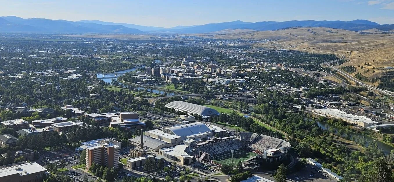
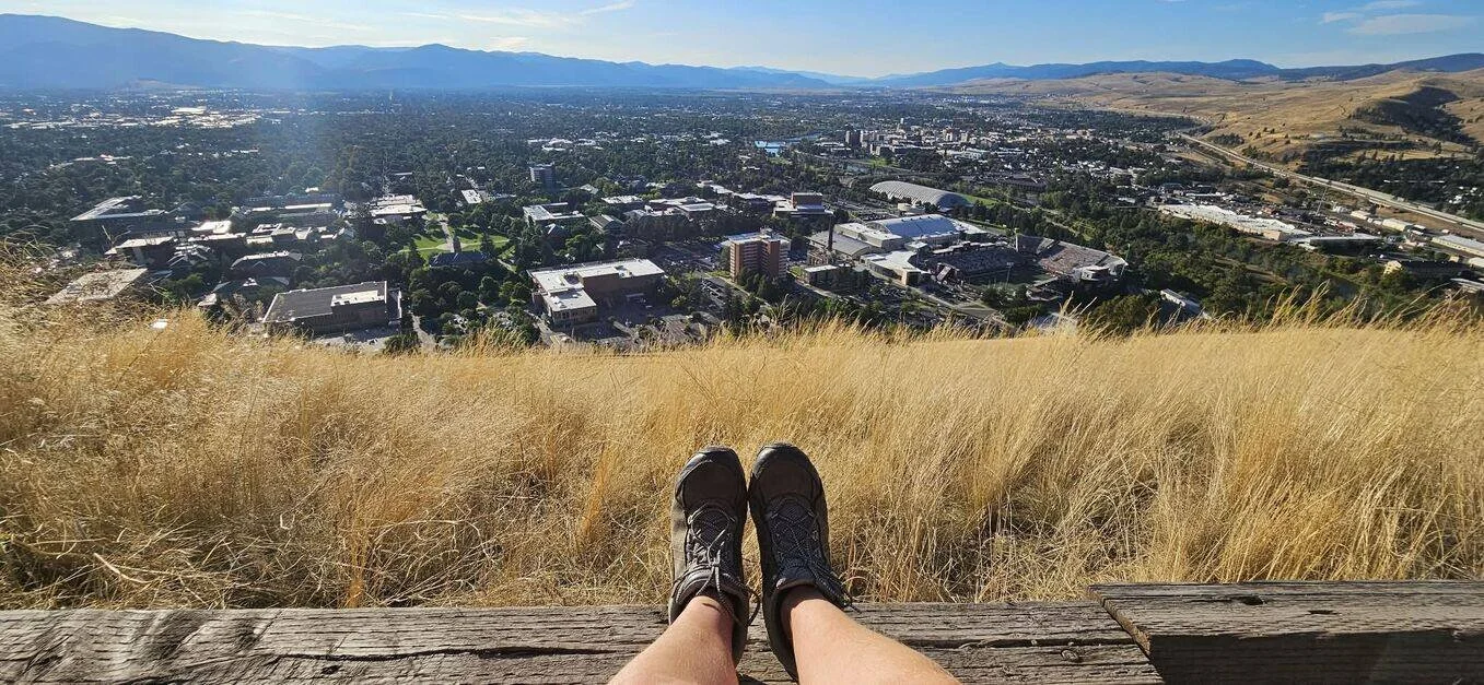
You’ll see the University of Montana campus, the Clark Fork River, Missoula Valley, and the mountains surrounding the town. The higher you get, the more the whole valley opens up.
At the top of the M, you’ll have gained about 620 vertical feet from the valley floor. And then there is the M itself. The concrete letter is about 125 feet long and 100 feet wide, so it is much bigger than it looks from down in town.
A little history of “the M”
The M has been part of Missoula for more than a century. University of Montana forestry students created the original trail and M in the early 1900s. The first M was made from whitewashed rocks in 1909 and was maintained by students who would periodically repaint it.
A wooden M replaced it for a short time, but strong mountain winds apparently had other plans. Eventually, a larger stone version was installed, and the concrete M you see today was built in 1968.
Over the years, the M has become much more than a symbol of the University of Montana. It has become one of those things that just feels like Missoula — a little bit of college-town tradition, a little bit of outdoor culture, and a little bit of yes, of course we're going hiking today.
And the M is not actually just for the University of Montana's name.
The M stands for Montana.
How hard is the M hike?
I would call it short, steep, and very doable if you're reasonably active. You don't need to be an experienced mountain hiker. You do, however, need to be okay with walking uphill.
There isn't much of a warm-up. You basically start climbing right away.
The hike is about 1.5 to 1.7 miles round-trip, with around 620 to 640 feet of elevation gain. The trail is dirt and has about 11 to 13 switchbacks, depending on how they're counted. It is considered moderately challenging and usually takes around one to one and a half hours round-trip.
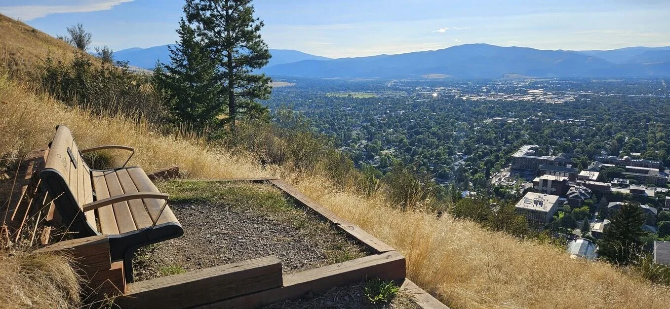
There isn't much shade, so on a hot summer day, I would probably avoid the middle of the afternoon. Morning or evening can be much nicer, especially when the light starts hitting the mountains and Missoula Valley.
And if you are hiking in the evening, as I did, bring a headlamp or flashlight for the way back if there is any chance you'll be out after dark.
Be nice to the people coming down
You’ll probably see University of Montana students running this trail, bizarre, I know!
On narrow sections of trail, general hiking etiquette is to give the ascending hiker the right of way when possible. They are working against gravity and stopping can interrupt their rhythm, so if you're heading downhill and see someone working their way up, step aside when it's safe and let them keep going.
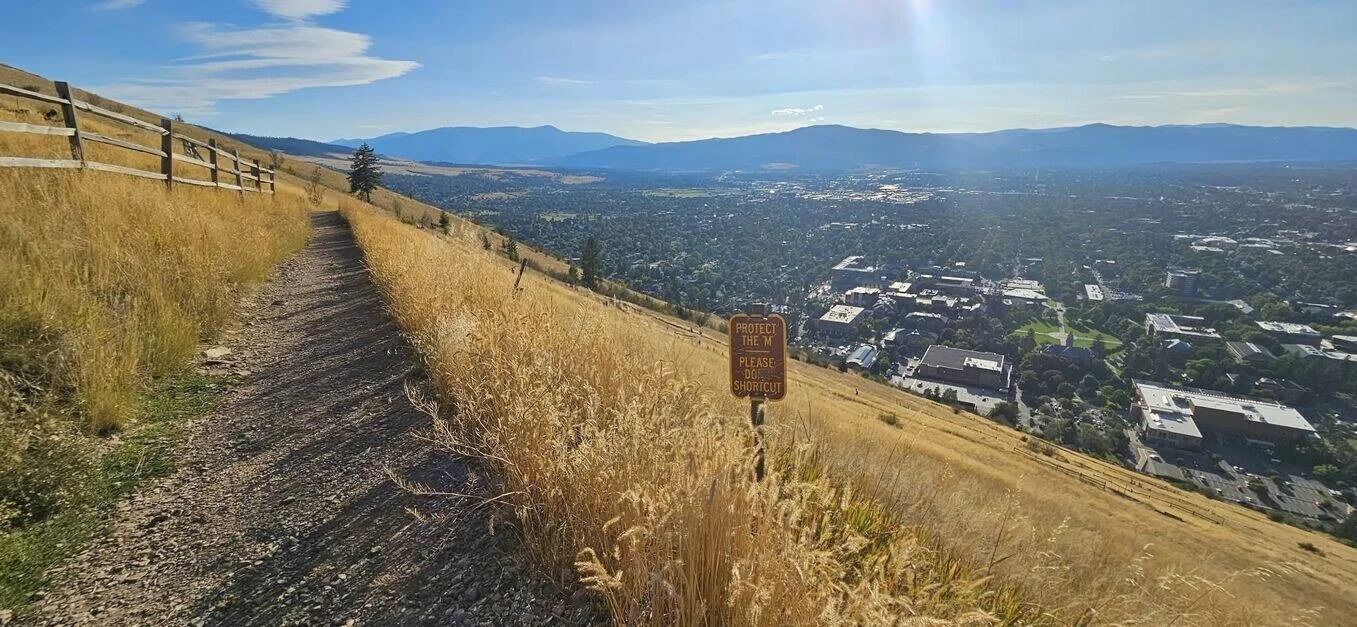
And please stay on the established trail.
The M gets a lot of visitors, and all those feet have an impact. Because the trail is steep and heavily used, erosion is an ongoing issue. Staying on the established trail helps keep Mount Sentinel beautiful for the next person who comes along.
The M Hike — Quick Facts
Location: Mount Sentinel, Missoula, Montana
Distance: About 1.5–1.7 miles round-trip
Elevation gain: About 620–640 feet
Time: Around 1–1.5 hours round-trip
Difficulty: Moderately challenging — short, but steep!
Trail: Dirt trail with about 11–13 switchbacks
Shade: Very little, so bring sunscreen and water
Water: Bring a water bottle; refill at the bathrooms below the trail
Bathrooms: Available near the trailhead
Best part: The higher you climb, the better the views of Missoula Valley and the University of Montana
Want more? Continue past the M toward the summit of Mount Sentinel and connect with additional trails
From The Hohnstead: About 25 minutes by car
Our tip: Go early in the morning or later in the afternoon/evening when the light is prettier, and the trail can be a little more comfortable.
You can keep going past the M
For some people, the M is the destination.
And that's completely fine.
But if you still have some gas left in your legs, the trail continues toward the summit of Mount Sentinel. From the M, you can continue roughly another 0.75 miles and gain another 680 feet before reaching the summit, which sits at about 5,158 feet.
There are also connections to other trails around Mount Sentinel and the surrounding open space, including routes toward Crazy Canyon and longer ridge hikes.
So the M can be a quick little Missoula outing, or the beginning of a much bigger hike.
Other hikes include: Summit Trail (Mount Sentinel Trail) – continues past the M to the summit
Crazy Canyon Trail – connects to the summit from the east side
Smokejumper Visitor Center Trail – for longer loops
Hellgate Ridgeline Trails – for panoramic ridge hikes
I hadn't hiked the M in 15 years
And this year, I decided that hiking the M would be one of my birthday activities.
My 41st birthday, to be exact.
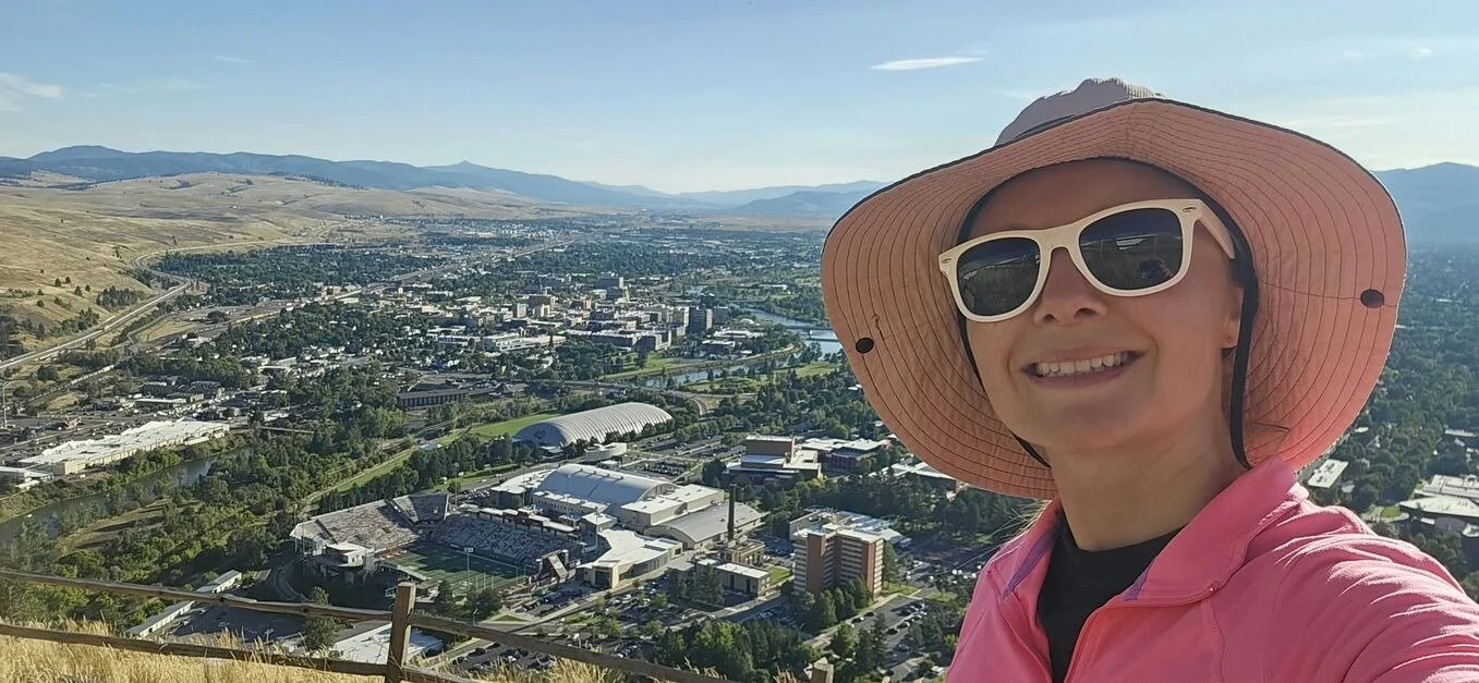
I went in the evening, and the light was absolutely beautiful. The trail wasn't very busy on the way up, although there were more people ascending on the way down.
And here's the funny part:
It took me about 25 minutes to get to the M.
After not doing this hike for something like 15 years, I got to the top and thought, Why don't I do this more often?
Sometimes we forget about the things that are right in front of us.
We go looking for some big adventure when there's an iconic little mountain sitting 25 minutes away.
A note about parking
Parking around the University of Montana can be a little confusing, especially if you don't have a university parking permit. There is a parking area directly below the M trailhead with spaces designated for hikers, but make sure you read the signs carefully and park only where you're allowed.
There are also bathrooms and a water fountain near the trailhead.
And bring your own water for the hike.
Make the M part of your Montana getaway
If you're staying at The Hohnstead, the M makes a really nice half-day outing.
You can wake up in the woods, drink your coffee, take your time getting ready, and then head into Missoula for a hike. Go climb the M. Walk around the University of Montana afterward. Grab lunch or coffee in town.
And then come back to your little cabin in the forest.
Because that's one of the things we love about staying out here.
You don't have to choose between being in the woods and exploring Missoula.
You get both.
The Hohnstead is only about 25 minutes from the M, but it feels like a completely different world when you come back.
And after climbing 620 feet up a mountain?
Your cabin, hammock, hot tub, and a very quiet evening might feel pretty darn good.
Come stay with us, go hike the M, and then disappear back into the woods.